
Sandymount Village Green

Sandymount Village Green
A CIVIC SPACE FOR VILLAGE LIFE
Sandymount Green is the heart of the village. This project will maximise the amenity for residents, businesses and visitors of the north-east side of the green. It will balance all interests by creating a dual function space. For most of the time, it will continue to act as a road for vehicular traffic and parking, and at certain times of the year it will convert to an attractive safe pedestrianised area for the community to mingle and enjoy the atmosphere. Dublin City Council is advancing this project and for more information on its progress. Click HERE link to updates
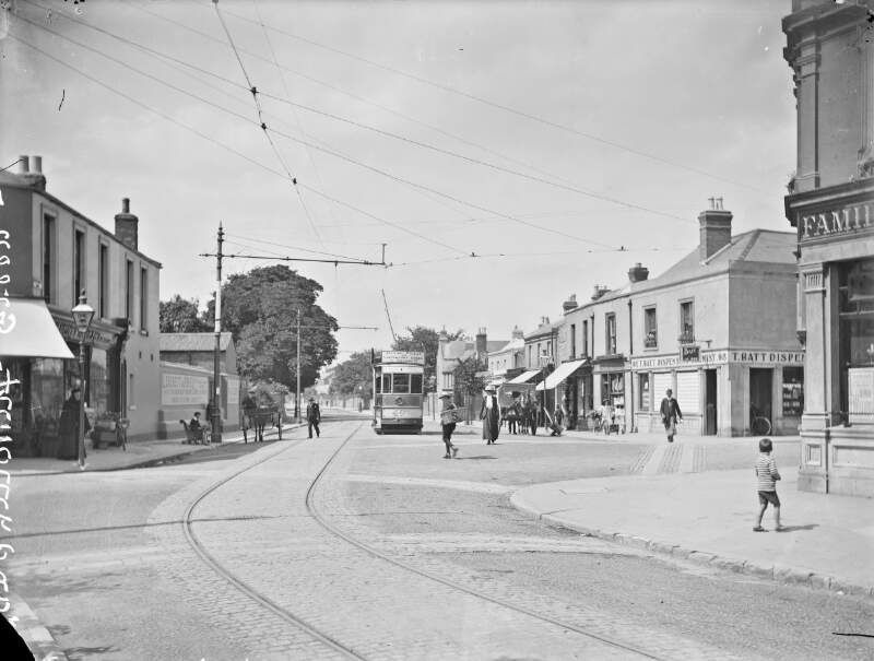
Sandymount Green was laid out in the early 1800s as a green with railings at the heart of the village. A bandstand and wrought iron drinking fountain were subsequently added, although have since been removed.
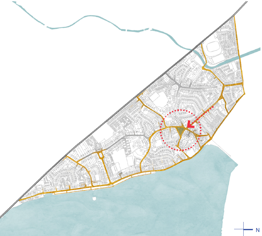
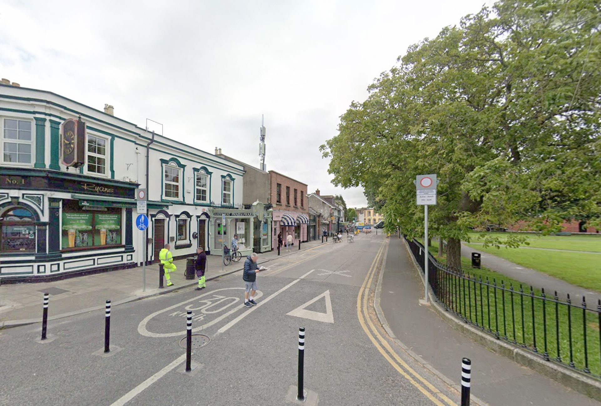
The north side of the Sandymount Green triangle is the most vibrant commercially and is the only side through which no buses pass. It is also south-facing with the most frequently used entrance to the green at its centre. It is the side of the Green best-suited to pedestrianisation.
The proposal envisages closing the northern edge of Sandymount Green to vehicular traffic with planters and removable bollards at the junction with Newgrove Avenue and with removable bollardsat the junction with Seafort Avenue, at the opposite end .
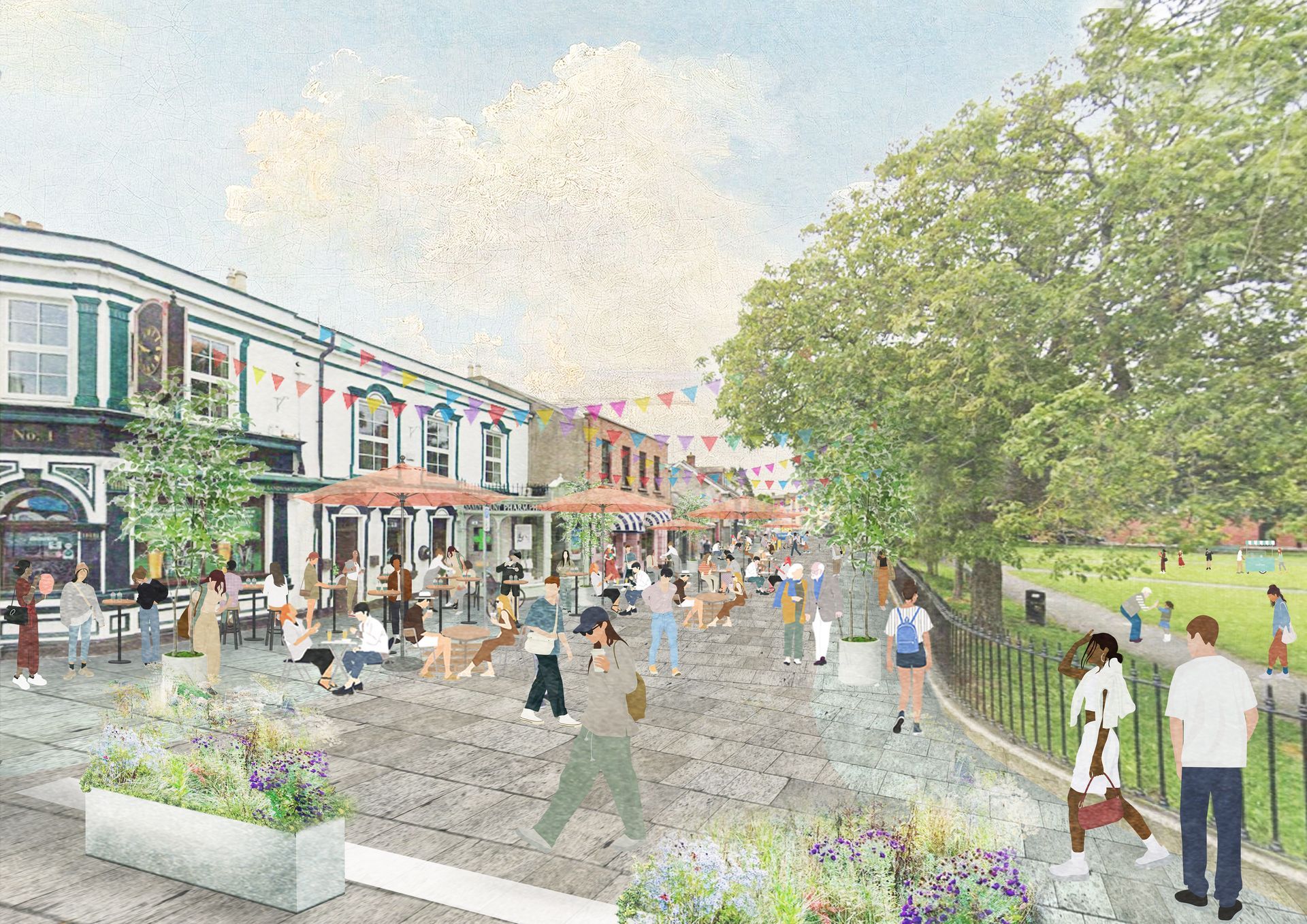
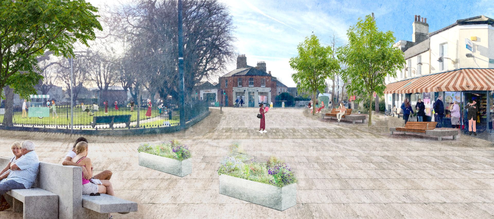
Imagined proposal view of the north-east side of the Green during pedestrianised period
Click pictures to enlarge
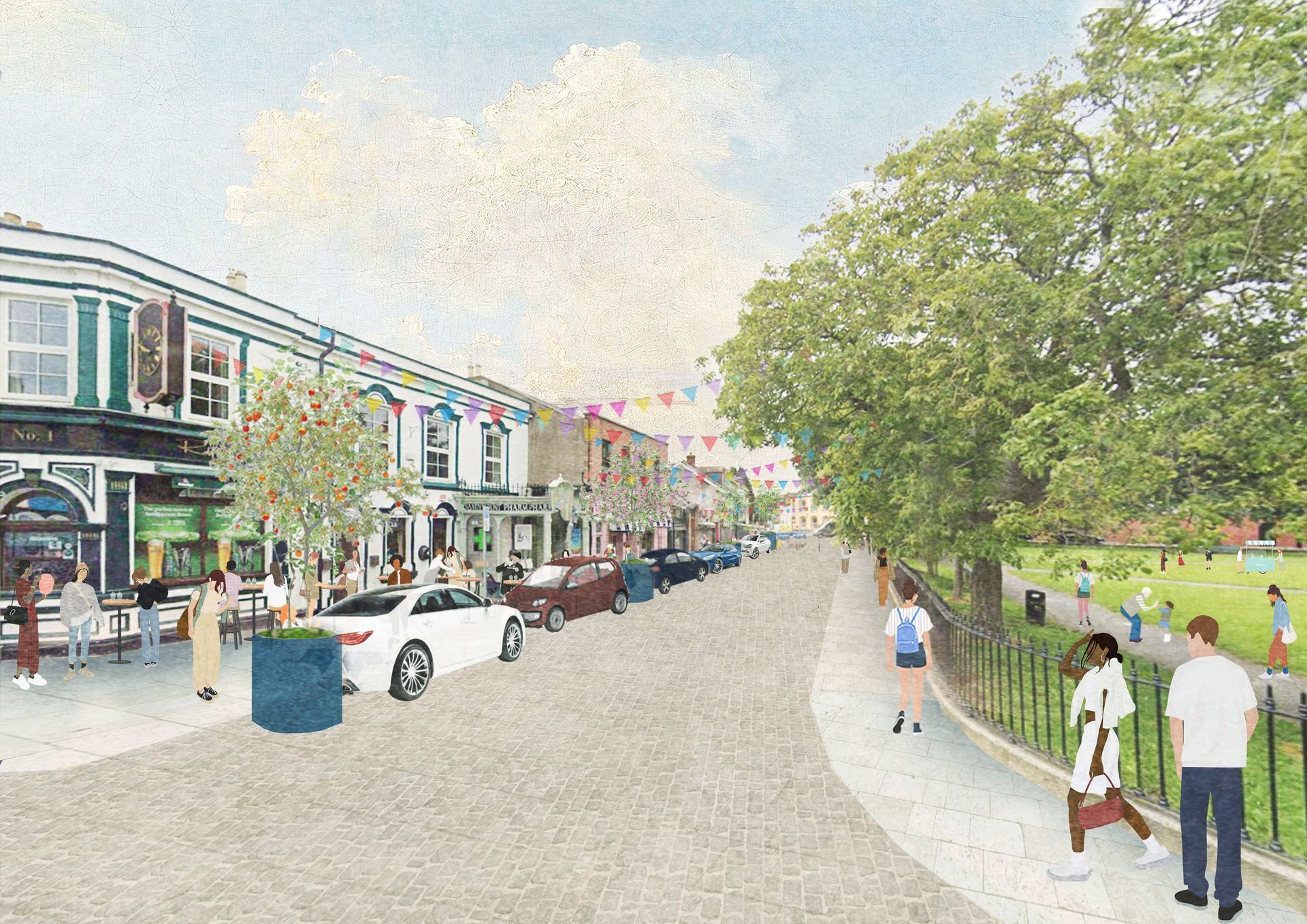
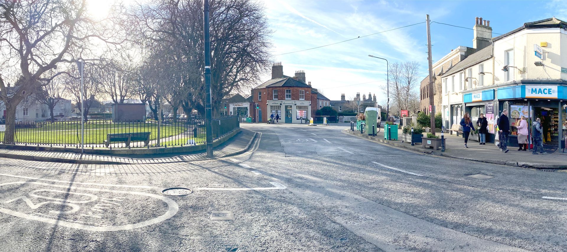
Imagined proposal view of the north-east of the Green during non-pedestrian period ie road & car parking
Click pictures to enlarge
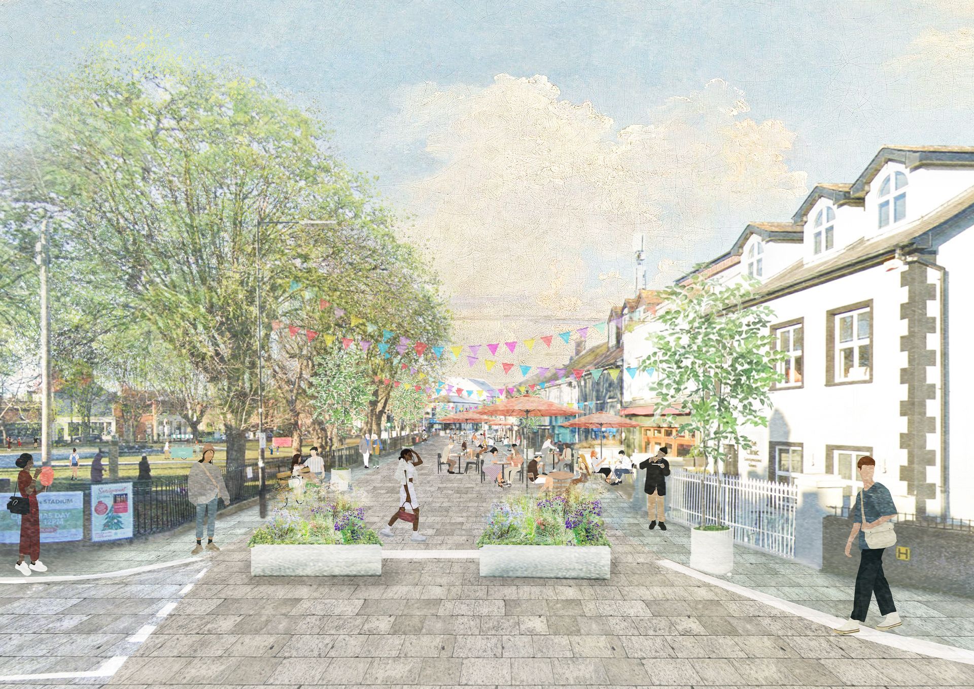
Imagined proposal view of resurfaced, pedestrianised area to the north-east of the Green
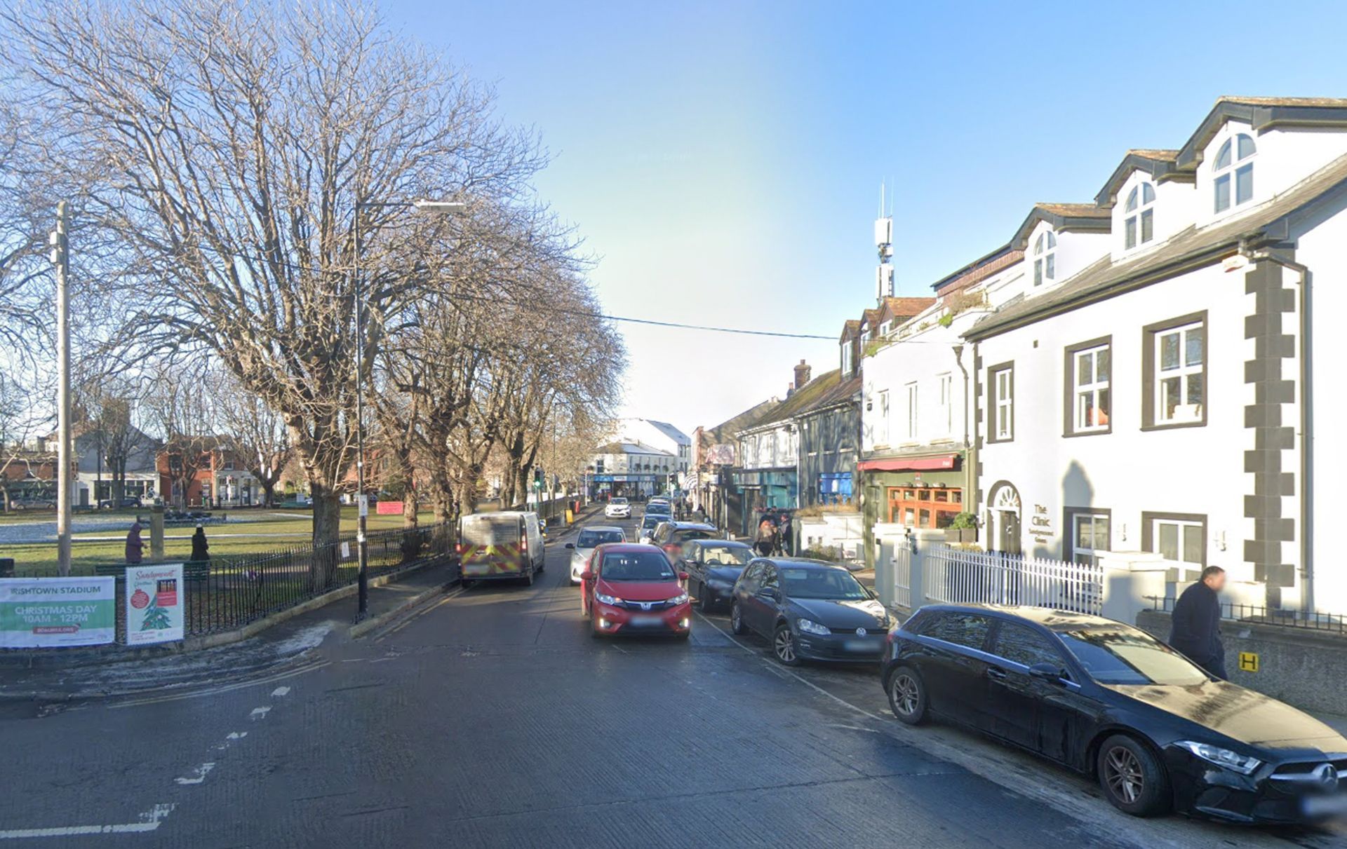
Repaving the full width of this side of the Green and removing dropped kerbs to create a level surface would create a more civic space for both passing through and for sitting outside the local bars and restaurants. The footpath adjoining the green is a narrow asphalt surface and there is no dedicated crossing point for pedestrians. Integrating this into a larger, higher quality surface would enhance the public realm as well as aid accessibility to the Green.
Historical map overlays showing the relative positions of the church and the waterfront as it has developed over time with the creation of Sean Moore Park.
The portion of the Green between Claremont Road, Sandymount Road and Seafort Avenue is an important through-route for buses as well as being the principle junction for vehicular traffic in Sandymount Village. This is not suitable for pedestrianisation, however it could be part of the same shared surface, having the effect of calming traffic, prioritising pedestrians and consolidating the identity of the nucleus of the Village in perceptual terms around a unifying ground surface.
There may be an opportunity to reapportion space back to footpaths and pedestrian zones by realigning and narrowing carriageways where they are unnecessarily wide and by reducing their bend radii as they turn corners. This would have the added benefit of reducing the velocity of traffic travelling around bends as it passes through the village. This additional space gifted to the pedestrian zone can also be claimed for the purposes of street furniture, fostering greater inhibition around the Green as a public space.
The existing bus route from Newgrove Avenue travelling along the Green’s south side needs to be maintained. This side of the Green by Sandymount Castle is much quieter with residential occupation unlike the other two sides of the triangle that are largely commercial. Pedestrianisation is not necessary for this side of the Green and as it is not part of the commercial zone of the Village, it is not necessary to include in the area of enhanced surfacing either.
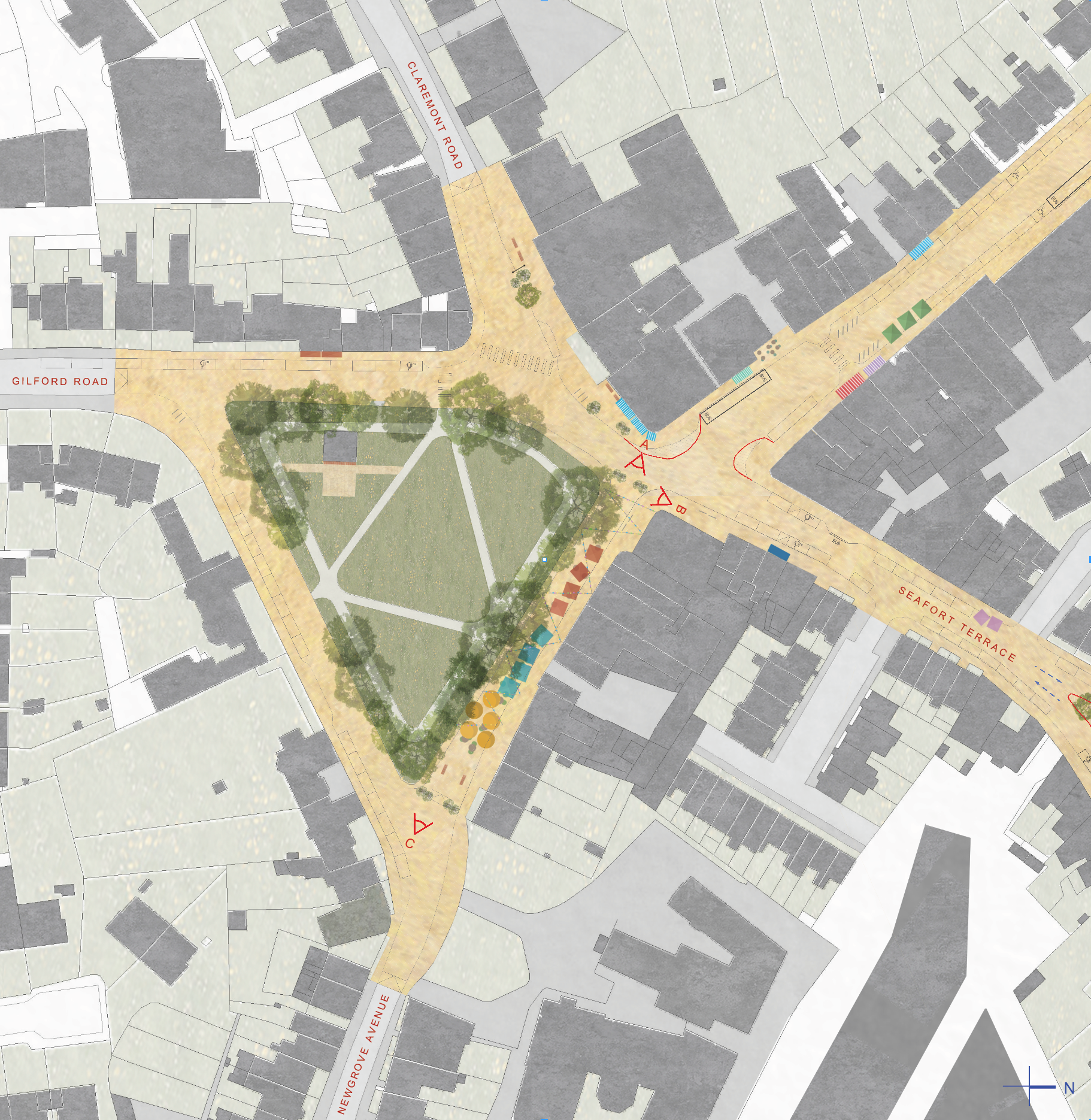
Imagined plan of Village Green
Click pictures to enlarge