
Historic Development of Sandymount
Timeline
1700s
1820s
In the 1730s, the natural soil of Sandymount was discovered to be suitable for brick production, the fundamental building material of 18th c. Georgian Dublin. Sandymount bricks were used to build Fitzwilliam Square, Fitzwilliam Street and the Pembroke Estate. This resulted in a cluster forming around what is now the Village Green (known then as Brickfield Town) to house workers associated with the brickworks. In 1810 Brickfield Town was renamed Sandymount reflecting the change in character of the locality from an industrial hinterland of the city to a desirable coastal suburb.
This transformation in character came in part as a consequence of the coastal defence works the Lord Fitzwilliam initiated in 1791. This was initially to protect the investments made in the brickworks but had the consequence of creating an elevated promontory that came to be a desirable setting for suburban villas to enjoy the aspect overlooking Dublin Bay.
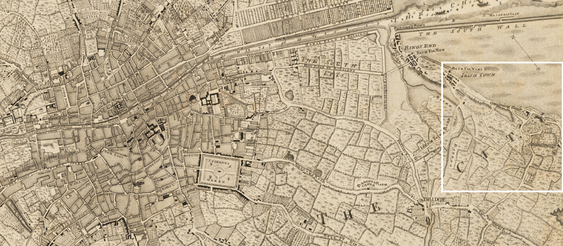
John Rocque’s 1756 map of Dublin and excerpt displaying the first development of Sandymount then known as Brickfield Town within the Fitzwilliam Estate.
ButtonThe low lying nature of the landscape of dunes, streams and lagoons informs the sinuous and meandering routes connecting the coastal villages of Dublin to Ballsbridge and Donnybrook. Rather than a planned, axial relationship, the routes appear to be improvised and organically formed by the landscape features than an imposed and planned overall idea.
These sinuous routes coursing through the Sandymount territory remain today and give it the character of being meandering and maze-like.
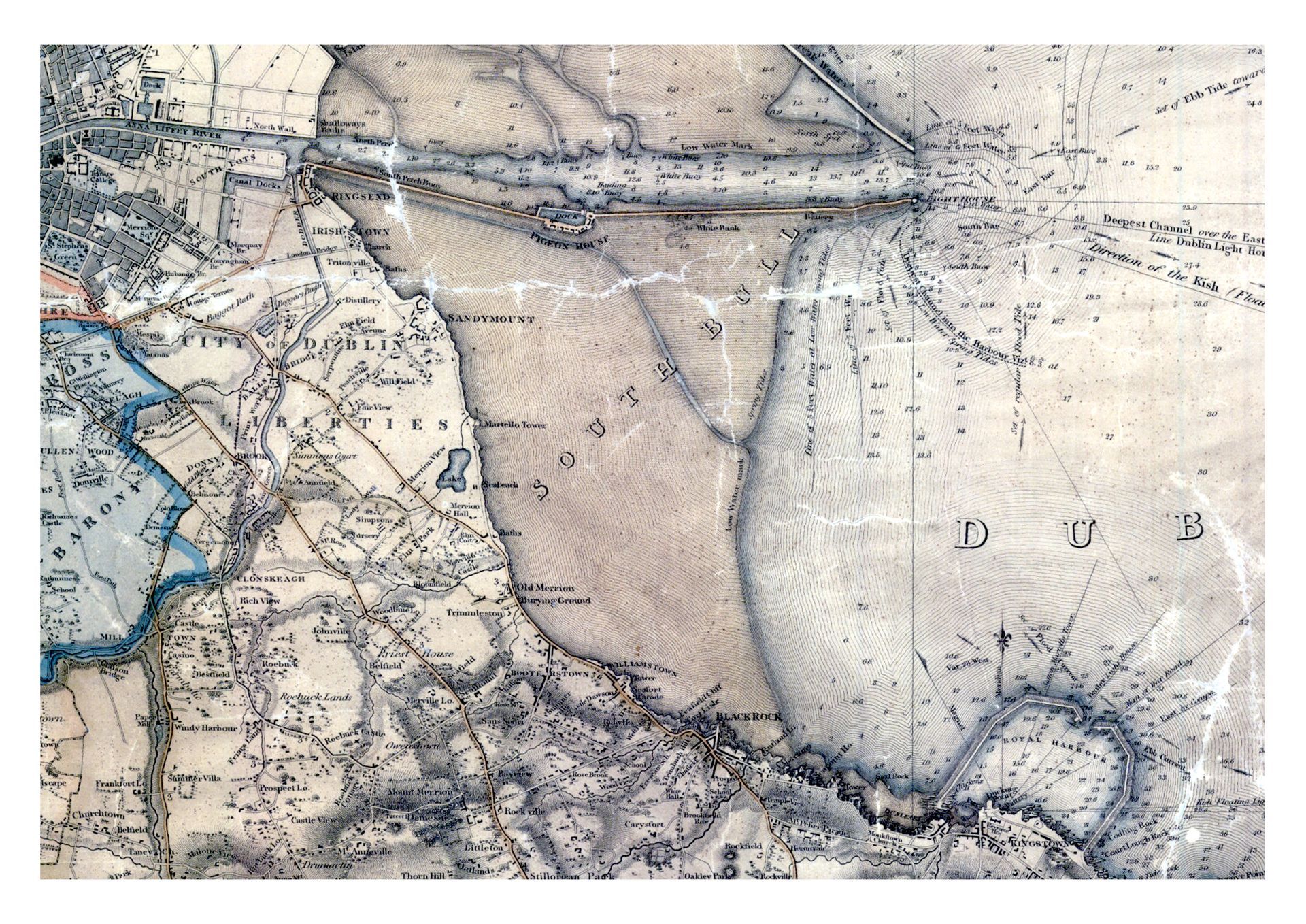
The broad territory of Sandymount within this study is wedge-shaped between Dublin city and Dublin Bay. Its formation that we see today can be traced between two of Dublin’s key infrastructural developments of the 19th Century, the South Wall and the Westland Row to Kingston railway.
The Duncan map of 1821 (see below) shows Dublin at the time of completion of the South Wall as far as the lighthouse but before the Railway to Dún Laoghaire. The line of the coast lies far further inland than where it is today. The consequence of the construction of the South Wall is the gradual deposition and reclamation of the landscape from the Sea. This now forms Poolbeg and the Glass Bottle Site and has moved Ringsend, Irishtown & Sandymount inland.
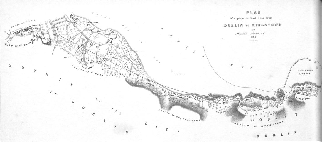
In 1830, Alexander Nimmo was commissioned by James Pim to chart a route for a railway line for freight transfer from the Harbour in Dún Laoghaire to the city. The strategy for the route was to determine the most efficient and economic route that avoided the existing villages of Sandymount, Ballsbridge and Donnybrook. The resulting route took its course through the empty hinterland between Sandymount and Ballsbridge creating a line of separation that continues today.
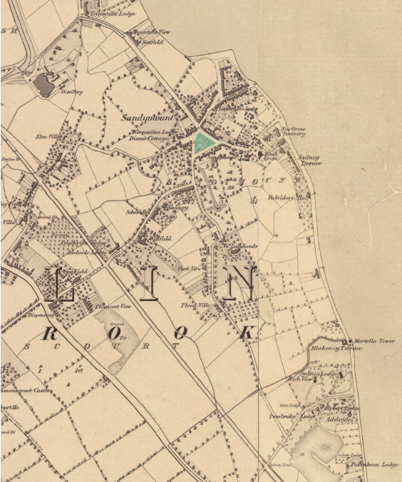
1837 Six Inch Ordnance Survey First Edition showing the recently completed railway to Dún Laoghaire (1834), Martello tower (1805).
Button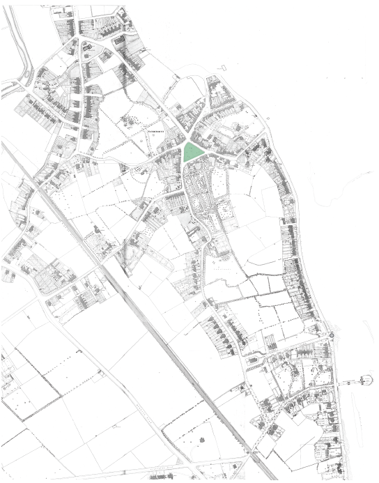
The 1889 map shows a clear development along the sinuous routes connecting Sandymount’s Village Green across the railway. The Promonade also shows expansion from the previous map as seafacing villas accumulate along the coast as Sandymount’s character as a seaside village for leisure develops. Note the positioning of the Merrion Pier at the terminus of Sydney Parade Avenue, connecting it to Sydney Parade Station and the newly built Ailesbury Road. St John’s Church was also constructed in the intervening period on axis with the Martello tower.
Button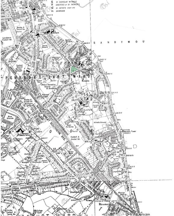
This 6-inch Last Edition Map made in the 1930’s displays the development of amenity grounds behind the garden walls of the houses lining Sandymount’s sinuous, garden-suburb roads and avenues
ButtonThe railway of the 1830s had the effect of concentrating movement across Sandymount to a number of key points, later to become locations of DART stations. This resulted in the accumulation of development along these arterial routes as land use intensified through the 19th Century.
The interior pockets of space within Sandymount’s parcels of development began to infill through the 20th century, occupying the last remaining void spaces in the territory. Sports grounds and recreational facilities claimed this space, many of which are still in use today.
Some of these sport grounds and open space have receded with greater intensification of development, particularly for housing. Some of the institutional estates have also ceded land for development and intensification of density with increased pressure for housing.
The 6 inch Ordnance Survey maps of the 1930s demonstrate how Sandymount transitioned from being a coastal village, proximate but apart from the city to being a suburb, absorbed into the city as well as to the adjacent suburbs on the other side of the DART line.